Author Archives: triplemultiplex

Ice, Ice, Baby.

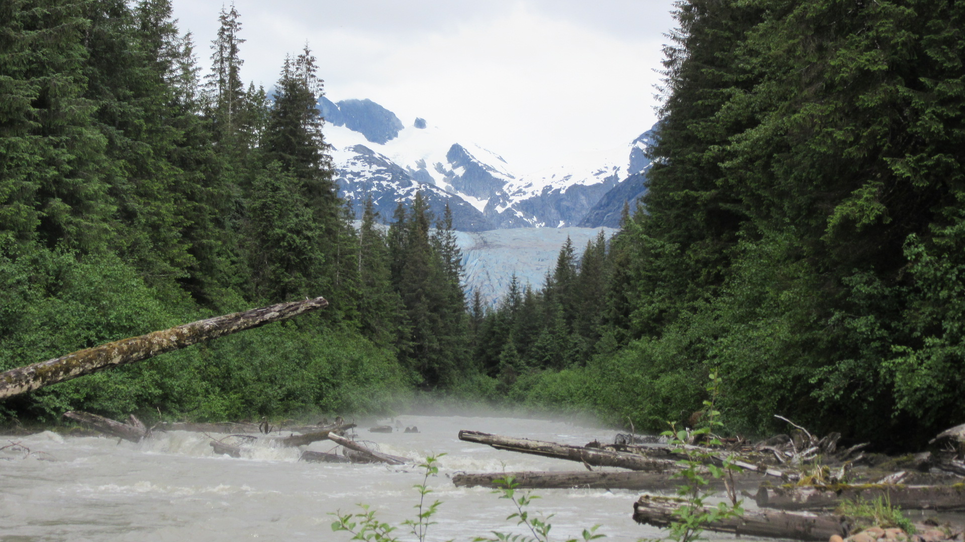
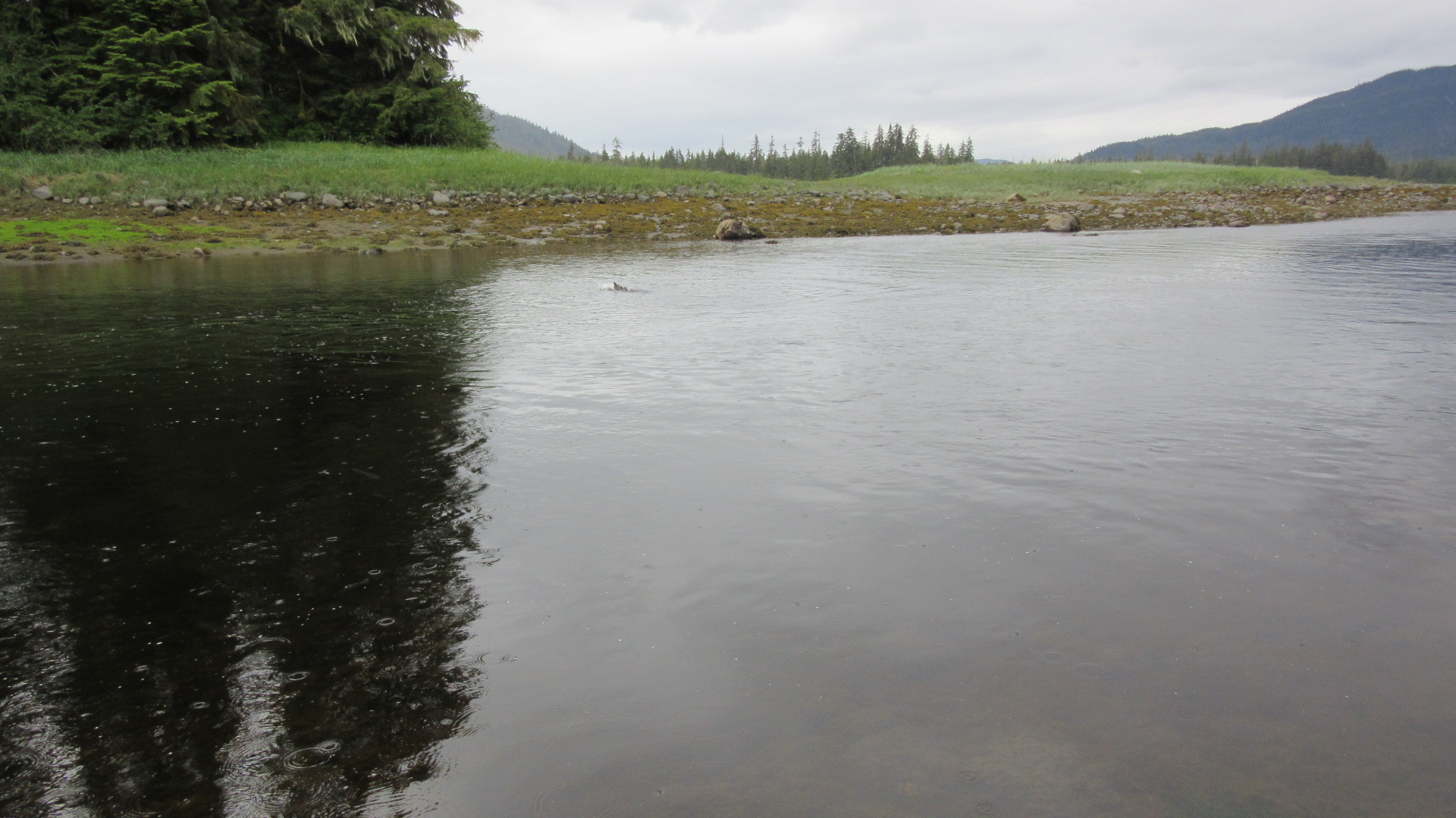
I took a hike to Mendenhall Glacier the other day.  As a person who is very interested in the geology of glaciers, it was a really amazing experience.  I know a considerable amount about glaciers and can identify the landforms they leave behind with relative ease.  Living in the upper Midwest means I’ve been surrounded by moraines and drumlins and eskers and all sorts of outwash features my entire life.  Now I finally get to come face to face with a glacier.

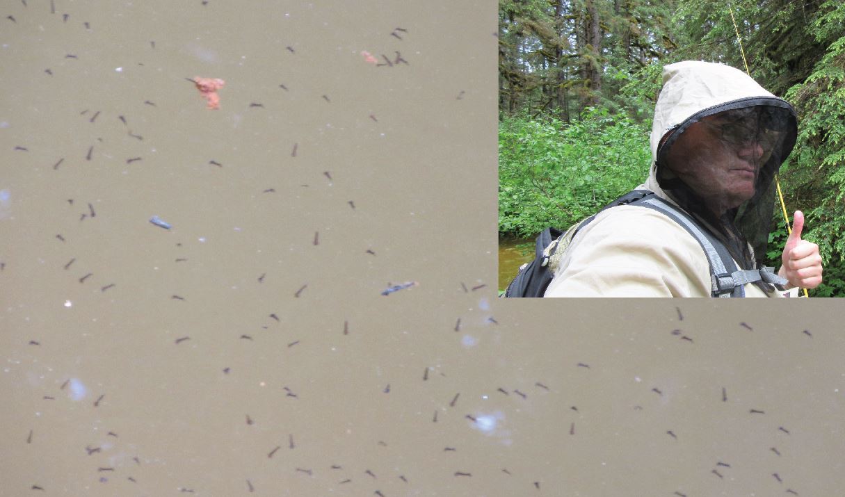
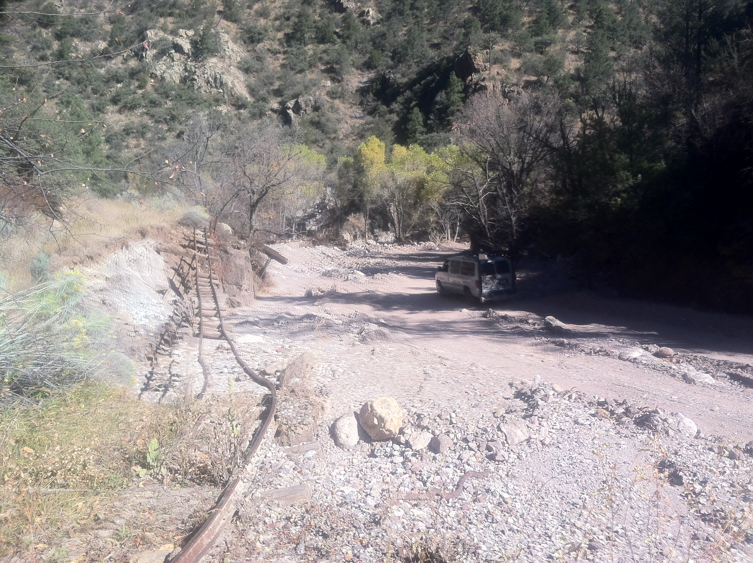
The hike was very rugged at times and there was even a rope involved at one point.  It was much more a ‘user maintained’ facility once it branched from the main trail for that valley.

The closer I got to the wall of ice, the younger the vegetation became.  Mendenhall Glacier has been in steady retreat since the 1950’s and land that has been buried for centuries or millenia is slowly being exposed.  This new land is at first sterile and devoid of life.  But as time passes and seeds have time to find thier way into places with enough nutrients to support growth, everything starts getting greener.  Close to the ice, the land looks like a construction site.  Grasses and small shrubs fill the gaps between in exposed bedrock a few hundred yards down valley.  The brush gets very dense where the soils have had time to develop.  They slowly give way to conifer forests where the trees are larger the further you are from the ice.  It’s a wonderful display of forest succession.

Then there was the main event.

IMG_0330

The expanse of solid ice is remarkable.  It awed me to think I was standing on a thousand winters’ worth of snow.  Though it filters the visual spectrum to make it appear blue, the ice is actually clear.  As you walk the surface, it crackles like small bubble wrap.  Scattered around are oblong holes that vary in size from “oh, neat” to “holy crap!”  I didn’t venture far on the ice for lack of appropriate gear and the very real danger of crevasses.  Unlike falling through the ice on a lake where there is water immediately below the surface, breaking through on a glacier might mean a tumble of hundreds of feet.

IMG_0332

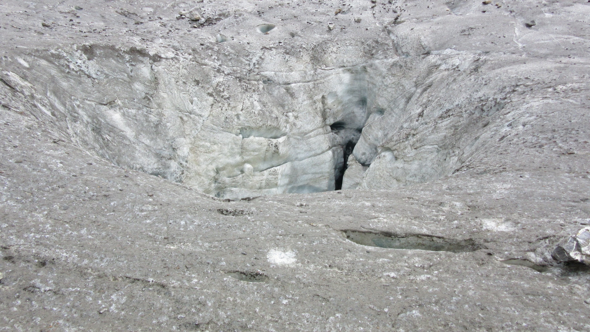
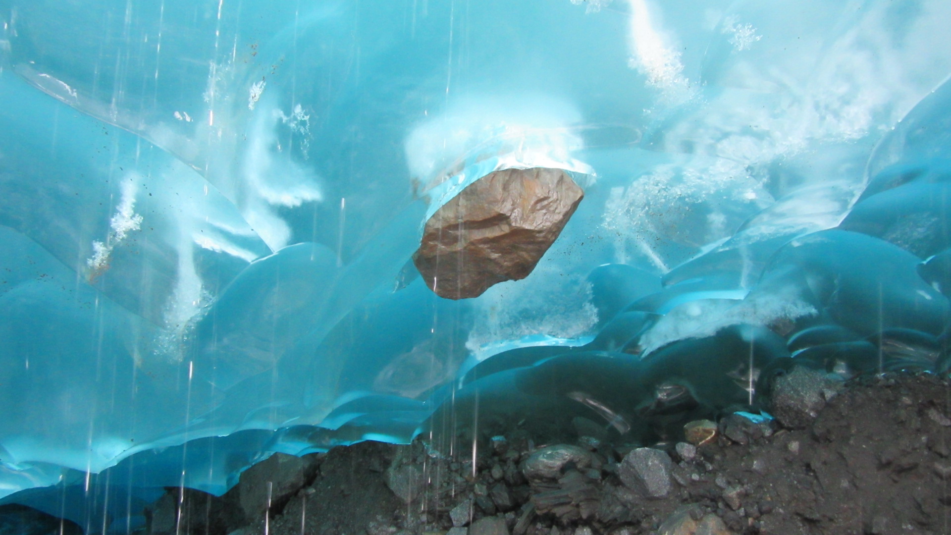
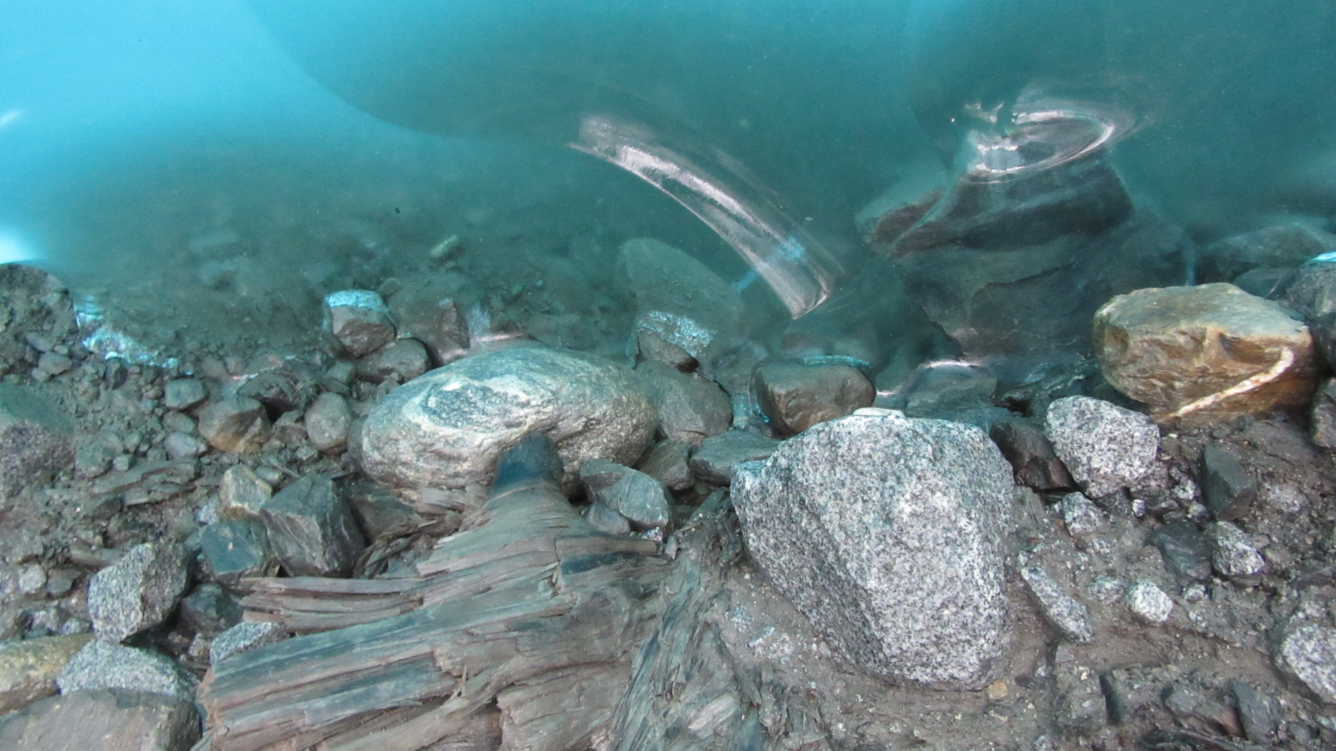
You’ll notice the surface is generally very dirty. The big rocks are obvious, but there’s also a thin veneer of mud over most places. All of this stuff was once inside the ice, but that ice has melted leaving this debris behind.  Imagine all of those rocks and all that dirt randomly distributed in a vertical space extending another 300 feet above you.  It’s a large-scale version of what we see every spring as piles of roadside snow melt away and start looking dirty as the sand mixed with it remains.

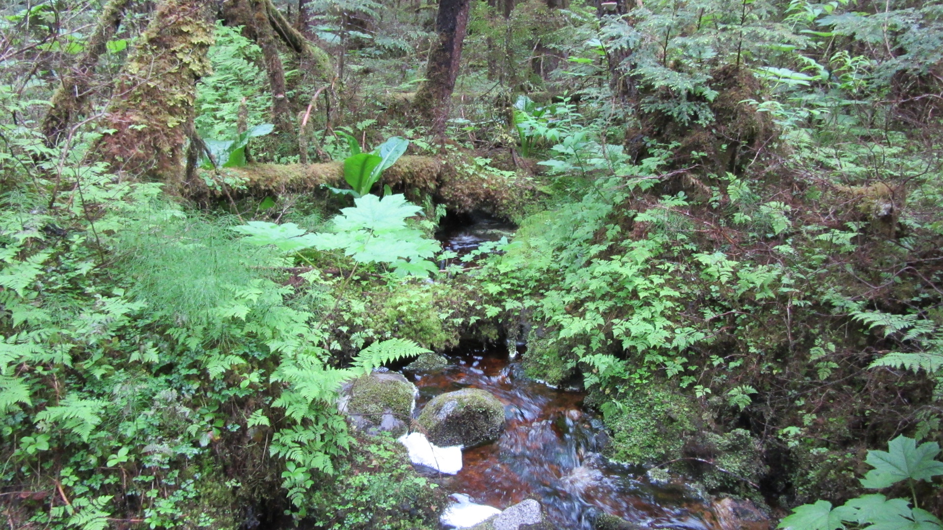
A short distance up-ice is a magnificent ice cave.  Here a tributary stream flows from the side of the valley and plunges beneath the ice.  For 60 or 70 yards, a person can easily walk in and watch this tributary join other meltwater beneath an opening in the glacier.

IMG_0350

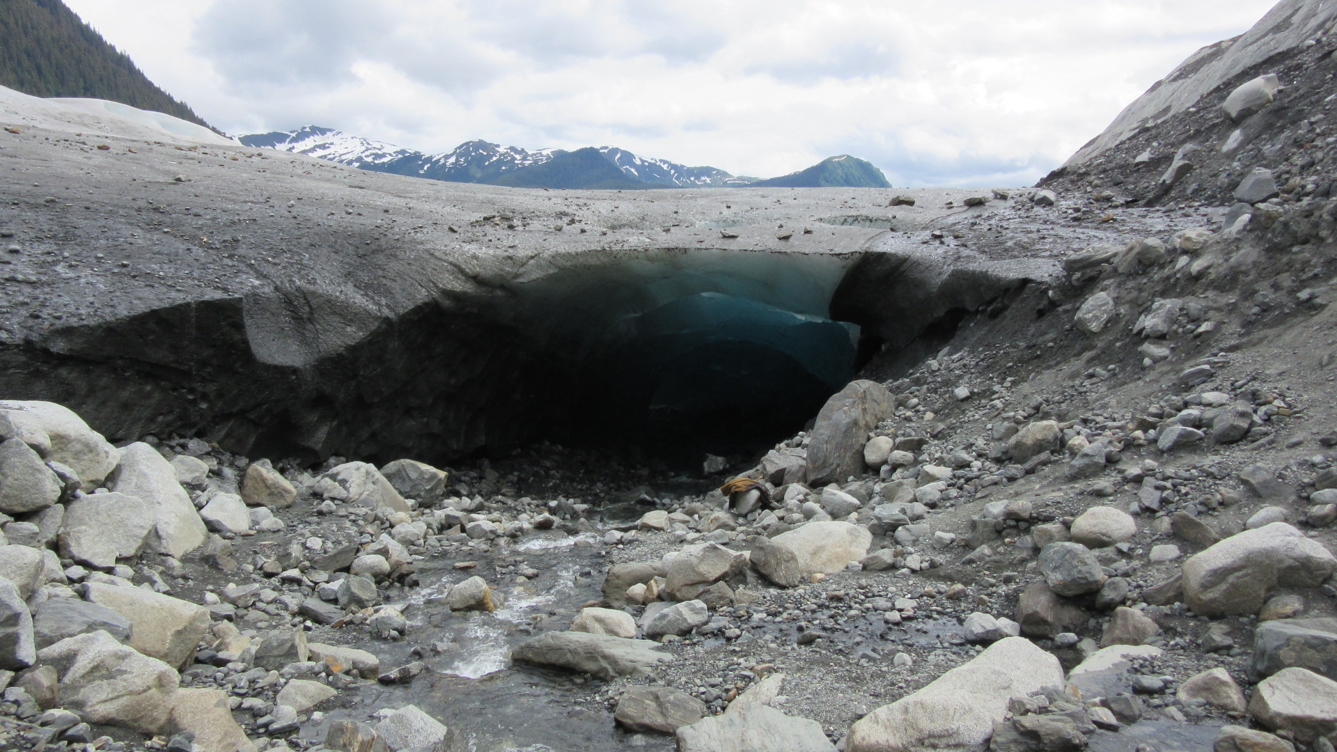
I have to nerd out for a bit and talk about eskers.  An esker, for those who haven’t done any hiking in the Kettle Moraine, is a long, narrow ridge made of sand, gravel and cobble that is formed by water flowing underneath a glacier.  This ice cave demonstrates exactly how they form.  This stream of water is currently walled in by ice on either side, so as it flows, sediment is accumulating inside.  When the ice melts away, the water will flow someplace else and leave behind this narrow line of gravel and rock.  Next time you stand on an esker, imagine this sight around you because that’s exactly what it would have looked like during the late Pleistocene.

IMG_0334

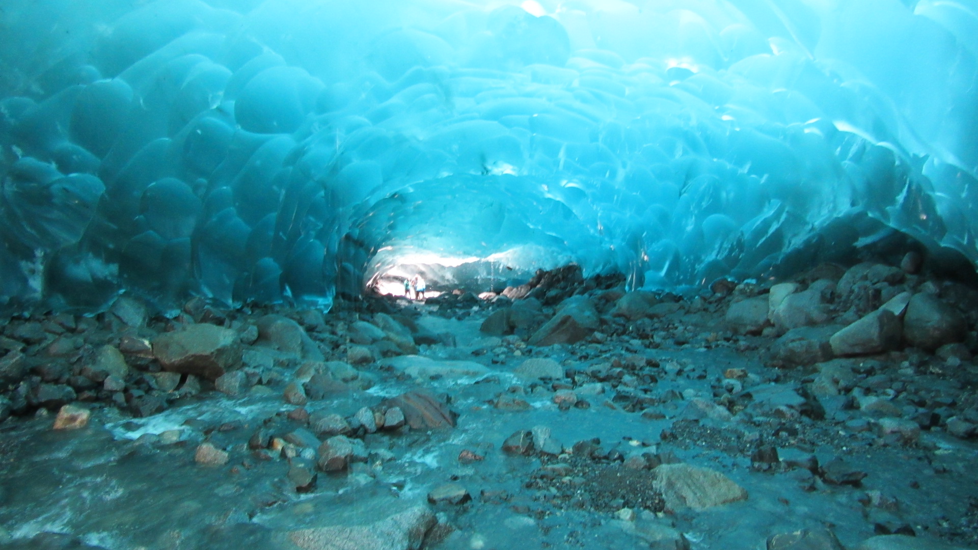
I can nerd out further and mention this particular location is not going to preserve an esker.  The land is far too steep and the accumulated sediment will erode away not long after the ice retreats from here.  But if this was flat ground, an esker would indeed remain.

Being inside the ice means you can see all of the debris that the glacier is transporting.  Everything from flecks of dust to giant boulders.  It demonstrates how glaciers move material.  It’s not so much an enormous bulldozer as it is an enormous conveyor belt.  The ice grabs onto these rocks and drags them along with it.  The material is released where ever the ice that holds it melts.

IMG_0343

IMG_0349

Up close, the ice looks more like frozen smoke.  It’s very smooth where it’s melting and it is extremely hard.  Glacial ice forms as layer after layer of snow builds up and compresses into ice as air is squeezed from it by the weight of the snow and ice above it.  Again we see this on a small scale every winter in the pile of snow next to your driveway.  By the time March rolls around, the base of that pile is solid ice.  Simply add a lot more snow and a lot more time to get a glacier.

There is so very much more I could talk about when it comes to glaciers and how fantastic it was for an Earth Sciences nerd to be snooping around on one.  Suffice to say I enjoyed myself a lot and it was well worth the difficult hike to reach it.

The Journey

There’s an old saying; “It’s the journey, not the destination.”  Basically, it’s shorthand for suggesting people enjoy the stuff they encounter while working towards a goal because it may turn out to be more valuable or interesting than the goal itself.  I think it is extremely relevant to fishing.  The goal may be to catch a specific species or a certain size fish or maybe just catch anything at all.  But it’s not going to happen every time.  Sometimes you are going to return without so much as a bite.  It’s part of fishing (and part of life.)  Sometimes you get skunked. Sometimes you break stuff.  Sometimes you get chewed up by bugs.

bug shirt

bug shirt

But you know where you never catch fish?  Sitting in front of a screen.
When you get out there, you might see a little corner of the world you never have.  You may encounter wildlife doing something you haven’t seen before.  Even if you’re going to the same ol’ fishin’ hole, you’re seeing it at a different moment from the last time you were there.  You can witness the subtle changes that happen across the seasons and over the years.  You’re in the great outdoors, surrounded by the natural systems your very existence is dependant on.  Fishing in particular makes you acutely aware of how connected the air and the water and the land are to each other.

I am currently in the state capital of Juneau.  We had a piece of equipment break down and are currently waiting on a replacement part, so I’ve got time for fishing, exploration and being a tourist.  On Wednesday, the morning’s rain was breaking up midday and I was intrigued by something I read in the fishing regulations.  There is a stream in the area that is only open to fishing on Wednesdays and Saturdays in the month of June.  It’s a tributary to a river that flows out of a glacier and it’s about a three mile trek to get there.  If nothing else, I figured it would be a cool hike.

That part was sure right.

Cool.

Cool.

That glacier is another three miles up valley.

All told, I put about seven miles on my boots and by the end, I was feeling sore and tired.  I got rained on a little, my feet were starting to get wet, I was pestered by mosquitoes and didn’t really get all that much fishing in.  The streams were too high and it was difficult negotiating the brush alongside them.  I ran into other anglers, some of whom were stinking up the area with thier stupid cigarettes.  I didn’t get out of the woods until after 8pm.  All this work and effort and what did I have to show for it?  Just this 15 inch cutthroat trout I released.

15" cutthroat from Windfall Creek

15″ cutthroat from Windfall Creek

Beautiful as it is, was it really worth all that effort?  Maybe not if we only judge this expedition based on the goal of catching fish.  But when we take into consideration the journey I took trying to reach that goal, we come away with a much different answer.  A vigorous hike into a place I have never before been; some cool wildlife and geology sights along the way.  The unquantifiable satisfaction that comes from enjoying something that most people want nothing to do with.

Catching fish is only part of the experience.  Near the end of my return trip, I gave my legs a rest and took a drink of water.  It was dead calm beneath the thick canopy and the woods were echoing with the calls of 3 or 4 types of bird.  The calls punctuated the background drone of the nearby river rushing over fallen timber and gravel bars and the foreground drone of a small trickle of water dumping over some roots.  Every so often, a woodpecker rattled the trunk of tree nearby.  I had to sit a moment longer to absorb the sounds and smells of the forest.  Marvelous.

visual for that soundscape

visual for that sound scape

I’m going to have to get a closer look at one of these glaciers.  That’ll be my next hike.

Chinook: King of the Salmon

As the largest of the salmon species, the Chinook or King Salmon is a prized catch for anglers the world over.  Alaskans call them Kings and in recent decades, have taken measures to ensure they will continue to test future anglers.  Stocking programs, closely monitored catch limits and protection of vital spawning habitat are some of the important steps they have taken to keep the population viable in the long term.

A few miles south of its only town, Mitkof Island, where I am currently staying, has a wonderful tidal estuary called Blind Slough.  At high tide, it’s a long, narrow, saltwater bay extending miles inland.  At low tide, it’s a rocky, freshwater river with riffles and pools.  It’s an ideal place for salmon to acclimate to freshwater before proceeding upstream to spawn.  Further inland, the Alaska Department of Fish & Game operates a fish hatchery to supplement natural populations.

The tide was low when I visited Blind Slough with my tackle.  The area around the access point was being used by other anglers or was too shallow, so I started trekking downstream.  A few riffles later, there was a long, wide pool that looked okay.  That’s when I started to see them jumping.

this, every minute or so

this, every minute or so

Fish that swim up rivers from the ocean to spawn can often be observed leaping out of the water where it doesn’t seem necessary.  If you ask why, you’ll get a jokey answer more often than not.  The most plausible explanation, though, is related to the fact that fish use different combinations of muscle movements for rapid bursts of speed than they do for swimming at a leisurely pace.  They’ve spent years mostly doing the latter in the ocean and now that they need to swim against strong currents and leap over obstacles, the fish need to build up the strength in their ‘turbo’ muscles.  Regardless of the reason, its a fantastic display to see large fish randomly erupting out of the water.  And a little frustrating when they don’t care about your lure.

Generally speaking, salmon do not feed once they enter freshwater during their spawning runs.  This can make it frustratingly difficult to catch them in rivers; especially when you can see so many of them scooting around and leaping about you.  A common tactic is to use flashy lures like spinners and spoons to goad them into aggression strikes.  As they work their way upstream, the salmon are constantly jockeying for position; especially the males.  There’s a lot of pushing and shoving and assertions of dominance.  It’s the reason the male salmon develop the hooked jaw; it’s a weapon to use against other males.  The fish see the flash of the lure and snap at it as a way to say, “Hey, back off, dude.”

This is the tactic I was using in Blind Slough.  I had some initial success with this nice coastal cutthroat trout.  They’re a lot like steelhead in that they are a sea-faring version of an inland trout species.

IMG_0237

After that it was a lot of casting without any catching.  Meanwhile, fish of all sizes were breaching right in front of me.  I was starting to entertain the idea of packing it in, so of course that’s when I finally hooked into a salmon.

And it was a big one.  After bumping into rocks and weeds all afternoon, I instantly knew this was a fish.  The rod arced and the battle was on.  First, he took off against the current to my left.  Several other fish leaped out of the water as the one I hooked streaked toward them.  The line scraped some algae off a rock and as the fish broke the surface, the green goop was flung from the line.  It was my first look at my opponent.  It was at least as big as any that I had seen leaping throughout the day.  And I could make out the hook in it’s upper jaw, indicating it was a big male.

A few moments later, that bad boy took off downstream peeling line from my reel while I held on for dear life.  When that big run was over, I tightened the drag a little and started to work the fish back toward me.  There was a lot of weight to try and pull against the current and I was ready to start walking down the rocky bank when the fish started coming back toward me.  I quickly reeled in to keep tension on the line.  It wasn’t long before the fish turned away and gave a brief surge toward the sea.  The tighter drag countered this move and he started slowly getting closer to the bank some 40 yards downstream.

Time to move.  In a heroic display of coordination, I moved along the bank across slippery rocks and the shallow water between them while holding tension on the line.  Getting slack in the line after such a long fight might allow the hook an opportunity to slip out.  Once I was even with the fish, it was pretty much over.  I drew him into the shallow rocky bank and breathed easy.  I got him.

IMG_0241

I had no accurate measuring device, but this King Salmon was around 40 inches, I figure, and had to weigh like 30 pounds.  Compare my boot (size 13) to the fish in both images.  Especially this second one since I’m holding up the tail in the first one.

IMG_0242

Long before I landed the fish, I was worried that I had snagged it.  Snagging is when you hit the fish with your lure as you’re retrieving rather than the fish biting it.  It can happen when you’re trying to catch large fish in relatively confined areas.  Doing this intentionally is illegal in most places as it is an unfair advantage to the angler and can lead to over harvest in addition to wounding fish that don’t get caught.  There are certain places in Alaska where snagging is legal for a limited time.  But Blind Slough is not one of those places.  If you do this accidentally, the fish must be released.

As it turns out, that is exactly what happened with this big King.  In the first image, the lure is still hooked into the fish behind the dorsal fin.  I could tell long before I landed it, too.  When they get hooked in the middle like this one is, they tend to go sideways once they tire and it makes them really heavy on the end of the line.  Any thoughts about having my next several meals taken care of faded with the realization that he was foul hooked.

This King of the Salmon would have to be returned to the water.  Once he was unhooked and photographed, I pointed him towards deeper water and held him upright until he was ready to go.  It was a really awesome fight and I was thrilled to examine one of these beasts up close.  But I will always feel like this catch is tainted because of the snagging.  It’s an asterisk that means I didn’t outwit this animal with a clever rouse.  It was the fishing equivalent of hitting it with your car.  Technically you got ’em, but “how” matters.  It’s less impressive.  I need to catch another one.  This time, hooking it the right way.  You better believe I’m gonna try!

Thar She Blows!

IMG_0186

My second whale sighting came a couple days ago.  This time, the camera was ready.  These two humpbacks were northbound in the Tongass Narrows just a few minutes outside of Ketchikan.

Best I could do with the inclement weather and distance involved.  The wake in the foreground is from a cruise ship which meant our ferry was further from the whales than it might have otherwise been.  But I’ve got a lot of boat rides remaining, so I’m sure there will be more chances.

Let Them Eat Kake

Kake is a tiny town on the northwestern coast of Kupreanof Island.  With very few roads, we had all of our work done by early afternoon.  I decided to fill my time on one of the streams I noted earlier along a road into the island’s interior.

Jenny Creek is comparable in volume to the Spirit River, up in my neck of the woods.  But its morphology is more similar to something you might see tumbling toward Lake Superior; bedrock outcrops, steep gradients and small waterfalls all surrounded by moss-draped forest.  The water was a bit low and long, shallow riffles connected the deeper pools.  Though it was mid-afternoon, the steepness of the valley and the dense forest made for low light levels.  While respectable by Midwest standards, this forest was clearly second growth.  Stumps and remnant logs 8 feet and more across were scattered among younger trees already 3-4 feet in diameter.

The first couple of pools yielded nothing.  But a little further downstream, a sudden tug on the line meant something found my 1/8 oz yellow spinner interesting.  It was this 10 inch cutthroat trout.

IMG_0137

It was the first of half a dozen small cutts.  For a time I thought some of them were rainbow trout because the parr markings on the smaller ones accentuated the irrendescence behind the spots.  But after further review, they were all cutthroats.  I kept none as there is an 11 inch size limit and that 10-incher was the largest of the lot.

I fished my way downstream for almost 2 hours until I came upon this 10-12 foot waterfall.  Not wanting to Bear Grylls my way down the “slippy” rocks, I started my return trek back upstream to the bridge.

IMG_0142

I was very much aware I was in the woods in bear country.  We saw a small black bear on the edge of town earlier that day and I passed another on my way to go fishing.  Bears have good hearing and an excellent sense of smell, but their vision is relatively poor.  As such, when hiking in bear country it’s adviseable to make a lot of noise so as not to surprise one.  An occasional shout of “Heeyyy bear!” is good.  So is singing out loud.  Anything that pitches your voice through a range of octaves is best as it makes it more likely you will be heard over the normal sounds of nature; especially along a stream.  Black bears are generally timid around humans, but around garbage dumps and other sloppy human activity, they might need encouragement to skeedattle.  In the woods, I’ve only ever seen them running away from me.

I’m a little over half way back to the road, when I hear a twig snap up ahead a little on the same side of the stream as me.  This gets my attention and I listen for anything else.  Another snap; this time a little closer.  Instantly I give a loud whistle and kick some rocks around, just in case.  Sure enough, about 30 yards away, an adult black bear appears at the base of the valley slope among the brush.  It was a heck of a lot closer than I was comfortable with.  I found it remarkable how well it was hidden by the vegetation; if that bear had been standing still instead of walking toward me, it would have been impossible to see.  I shouted at the bear, “Go on, get outta here!” and he scrambled up the steep slope several dozen yards before stopping to look at me.  Another word of encouragement and the bear disappeared into the dense forest.  I continued my hike back to the road on the other side of the stream.

IMG_0145

It was an exhilerating experience.  The twinge of danger and subsequent fight or flight decision was very raw and primitive.  The relization that it was ‘just’ a black bear is darkly humorous to me.  “Phew, the probability of mauling dropped from ‘slightly possible’ to ‘extremely unlikely’; what a relief!”
It’s been a long time since I’ve seen a bear while hiking in the woods.  It’s a much different experience when you are in their element, rather than spotting one from a car.  There’s always a tiny rush of fear because these creatures have the hardware to mess you up, but not usually the desire.  So when they immediately high-tail it away from you, the relief is very satisfying.  “Okay, we understand each other, bear.  You go that way; I’m going this way.”

Deadliest Cash

Ten years ago, the Discovery Channel debuted a unique (at the time) type of reality show about dudes fishing for crab on the Bering Sea.  This was back when there was still good stuff on the Discovery Channel, so I was quickly roped in by it.  Unlike all of the subsequent would-be imitators across basic cable, there was something compelling about the people featured on the show.  They do a fantastic job editing together character arcs for some of the fishermen involved over the years that has held my attention for a decade.

I’m not the only one who has enjoyed the program since it quickly became Discovery’s highest rated show.  Then they made the mistake of trying to make the entire network look like that and it eventually lead to its precipitous slide into the mostly terrible garbage that pollutes my former favorite cable channel.  But Deadliest Catch still holds up.

Deadliest Catch merchandise is a mainstay of all the gift shops that line the waterfront of Ketchikan and I’m sure every other port of call in Alaska.

as seen on TV

as seen on TV

Yesterday, one of the boats that has been featured on the show steamed by.  The Tongass Narrows in front of Ketchikan make up part of the “Inside Passage”; a navigable path for ships large and small among the islands between Puget Sound and the Gulf of Alaska that is protected from the open ocean and is the preferred route for most vessels.

F/V Kodiak

This is the F/V Kodiak which was on the show when it was captained by the big dude with the large beard and long, white hair.  He’s running some other boat on the current season.

A different Deadliest Catch alumni is quite obviously no longer in the commercial fishing game.  The F/V Aleutian Ballad was on a couple early seasons of Deadliest Catch.  These days, it capitalizes on the popularity of the show by taking visitors out on guided tours.

F/V Aleutian Ballad

Yes, that’s two levels of stadium seating that have been installed to accommodate tourists.  Seems like a humble second life for a ship where men used to risk their lives in pursuit of high-end seafood.

Speaking of which, I have the gear and licenses I need to start plying the local waters for my own not-so-deadly catch.  Because of the amount of stuff we needed to fly up with for the job, and because of my distrust of the airlines to properly handle any of my fishing rods, I’ve elected to buy new gear up here.  Also none of my stuff was at the same time sturdy and portable enough to bring along.  With another rain day in the forecast for tomorrow, I plan to test out the new equipment on some area waters.

The Tourists

Ketchikan often reminds me of some of the major vacation towns in northern Wisconsin.  Similar to Minocqua, Hayward, Eagle River or my own home town, it started life as a base of operations for extraction industries; timber and fisheries.  But as time passed and those resources were over-exploited and then closely regulated, a wholesale shift occurred toward tourism.  The only differences being how long ago it happened and how the tourist get there.  The transition to a tourism based economy happened within my lifetime.  And instead of the tourists streaming up Highway 51, the tourists pour off of the 2-4 cruise ships that are docked here at any given time over the summer.

If you have ever been on a cruise ship anywhere in the world, you have an idea of the size of the ones that park themselves bow-to-stern here in Ketchikan.  The Tongass Narrows (the waterway between Ketchikan and its neighboring island) are no wider than the Mississippi River is in the upper Midwest so these large ships are even more impressive in this context.

IMG_0090

Among the locals I’ve talked to, there is a bit of nostalgia for days of Ketchikan as a major fishing port and lumber town.  But at the same time, they cannot deny the immense and vital revenue stream that comes with these cruise ships.  It’s basically the reason this town exists nowadays.  Still there’s always a bit of melancholy about a place that now has to cater to those with disposable income.  It’s the downside to living in a beautiful place.  Other people want to come and gawk at it, take pictures of its quaintness, pick up a T-shirt and an embossed shot glass as proof that they once visited someplace cool.  It’s a balance between the pride such attention fosters and the resentment of dealing with people who have expectations about a place based on a brochure or a website.  You’ll have that any where tourists congregate.

There is a townie bar near where I am staying and I have had the opportunity to get some older dudes to start talking about this and that.  It’s one of the more interesting aspects of traveling so much.  You invariably get to talking to some local about whatever if you post up at the right bar.  I feel like people open up a little more about their town when you tell them you’re there for work instead of leisure.  There is less obligation to impress and you get more straight talk about what’s good and what’s bad.

Ketchikan

Now that the internet is working, I can start posting from Alaska.

In just one day, I’ve already seen a couple of seals, four giant cruise ships and even a glimpse of a whale.

Ketchikan’s airport is on a separate island from the city requiring a short ferry crossing.  While waiting for that ferry today, this small whale randomly popped up for a gulp of air.  Small is a relative term; it was still at least 20 feet.  I have no idea what species it was, but it was still really cool.  The whale didn’t make another appearance before the ferry started loading, so I didn’t get any pictures of it.

Instead, here’s your standard Alaska picture of eagles sitting around on something man made.

Two Eagles

That’s our hotel underneath them.  It’s a decent spot; a four story building right next to the water.  I got myself a new camera before this project and already I’m getting better shots of more distant subjects like these two baldies.  Good purchase.


Klondike Jake

Apologies for the hiatus, but sometimes you just don’t feel inspired.  It’s not like Utah was bereft of gorgeous scenery and interesting stuff to do.  I just didn’t really feel like writing anything.  Snow capped mountains, desert valleys, a vast inland sea and an unexpectedly cosmopolitan city; that about summarizes my time in the Beehive State.

I also skipped over the few days I spent in Portland, Oregon.  Beautiful city with loads to do.  Plus when the dense vegetation allows, you can see volcanoes!  Mt. Hood and Mt. St. Helens and their snow-white peaks stick out very well against all the green of everything else.

Then there was the annual fishing trip to Canada over the Memorial Day weekend.  Fish were caught, beers were drunk, good times were had.

I will be posting a lot more during this next project because in 48 hours, I will be in southeast Alaska.  Yes for the next two months or so, the islands and fjords and passages of our largest and wildest state will be my office.  The job is the same, only the setting will be different.  That and the “Alaska Marine Highway”; a fancy name for the system of ferries that transport people, vehicles and stuff from island to island to mainland areas unconnected to any other inland roads.  This is going to be quite the adventure and I will do my best to keep everyone updated. Not every place has internet, though, and I will probably spend more than one night camping.

Adios, New Mexico

I bid New Mexico adieu today. It’s been an interesting job but it’s nice to be done. Next week, I come back to the southwest for a project in Utah. I only have a few days to enjoy the “outstanding” winter they’re having back home.

20140303-094431.jpg
That’s the evening sun in downtown Albuquerque with a freshly snowed Sandia Peak in the background.
(Reporting from a bar inside the terminal of Albuquerque International Sunport.)

Brush Fire

There was a small wildfire kicking up a lot of smoke just over the Texas border from me today.

Image

First saw the smoke about 50 miles away and eventually made it to about a mile from the blaze.

It was burning short grass prairie covering a dune field that straddles the Texas/New Mexico border east of Portales.  Somewhere around here: http://mapper.acme.com/?ll=34.21493,-103.02223&z=13&t=H

Been at least two weeks since I’ve seen any precipitation in these parts; it came in the form of a modest snow dusting.  So, yeah, it’s been dry.

Dinosaurs

Albuquerque has a really nice natural history museum that I got a chance to explore last weekend.  Something about having a museum in a state where you can find actual dinosaur fossils makes them really bring it.

Image

Nicely done, New Mexico.

I’ll be spending Super Bowl Sunday in lovely Roswell.  Already seen one group in the hotel sporting Seahawks jerseys, but most folks in this state seem to be backing the Broncos.  All the guys working the New Mexico project are getting together to watch the game, so that should be a good time.

I’ll mention it was 74 degrees here today and hope it doesn’t sound like I’m rubbing it in to all my peoples in the Midwest.  8)

Atop Sandia Peak

Took some time this evening to checkout the Sandia Peak Tramway here in Albuquerque.  A fifteen minute ride lands you near the summit at an elevation of over 10,000 feet.  The top was considerably colder and windier than the base, but the view was totally worth it.

Image

A nice sunset view and a good restaurant were waiting at the top of the mountain.

McAllister Lake

Needing a little outdoor time before settling in to watch football this afternoon, I ventured a few miles outside of Las Vegas, NM to a nearby national wildlife refuge.  Just an aside, Las Vegas, NM decidedly less exciting than Las Vegas, NV.  While it may have had an interesting past, today it’s basically a convenient pit stop about halfway between Santa Fe and Colorado.

Anyway, the wildlife refuge contains several small lakes, the largest of which is called McAllister.  Diversion of water from a nearby river usually keeps enough water in McAllister Lake to support a population of game fish.  However, starting a few years ago, long term drought in the region meant water was no longer available for the lake and it is now a shadow of it’s former self.

For comparision, here’s the lake as represented by 1:24,000 topographic map from the 70’s:

http://mapper.acme.com/?ll=35.52165,-105.18089&z=15&t=T

Now here it is in a more recent aerial photo:

http://mapper.acme.com/?ll=35.52165,-105.18089&z=15&t=S

It’s actually completely dry and the white is evaporated mineral deposits left behind.  Today, there was some water in it, but much of the lakebed was exposed revealing various debris left behind by careless or unfortunate anglers.  A walk around the lake was like visiting a museum devoted to the last 40 years of packaging of cheap beer.  Other objects were more interesting.

Image

Here lies an old fishing pole, an empty Coors pull tab can, some undefined mechanical part and a half buried tackle box.  The meager remains of the lake are iced over in the background.  A pair of tumbleweeds have taken root in the silt.  Reminds me of photos I’ve seen of the Aral Sea in Central Asia where boats sit decaying miles from the current shoreline.

This photo captures a decades old boating mishap.  It is also a reminder that people flocked here not too long ago to spend an afternoon on the water and try their luck at the Rainbow Trout that were once stocked here.  I got there a few years too late for that.

Seeing all those empties sticking out of the mud really makes me wish people weren’t such jerks about littering.  Bud, Coors, Miller, Pepsi, Schlitz, Hamm’s; I even saw a Stroh’s and something called “Meister Brau Light” from Miller.  I shutter to think this is what it looks like beneath the lakes that I frequent back in Wisconsin.  C’mon, people, pack out your trash!  Keep America beautiful.

Image

Raton

Raton is the first town you encounter when you enter New Mexico from the north via the interstate.  The name is actually Spanish for for ‘rat’ or ‘mouse’ which adds a bit of humor to any number of business that include the city’s name in their own.  (Want to stay at the “Rat Hotel” or eat at the “Mouse Cafe”?)

It’s a beautiful place, though.  Nestled between the Sangre de Cristo Mountains to the west and some younger volcanoes to the east, Raton sits on the transition from shortgrass prairie to mountain conifer forest.  That location was key to probably my best wildlife sighting since I’ve been here.

A little south of here, there must have been two to three hundred elk in two large groups between I-25 and US 64.  One group in a low valley, another up on a low ridge.  Both kept their distance from a small group of cattle.  They were way too far to get a good photo.  All I could do was watch from a distance as the group on the hill started to make its way down toward the group in the valley.  Magnificent.  I haven’t seen that many elk outside of a National Park ever.

I’m leaving this area tomorrow and just in the nick of time.  24 hours from now, they’ll be getting snow around here.  Several inches.  Good thing I’ll be going back to Wisconsin, away from all that.  Heh, heh.

Downtime


Image

I had some free time at the end of last week due to some faulty equipment.  Fortunately, we happened to be Santa Fe and took advantage of the many restaurants and bars in the old school downtown they have.  They are between tourists seasons in Santa Fe this time of year.  Between the end of the late summer/early fall Fiestas and the ski season, the town is pretty quiet.  But we still managed to catch some live music and eat a wide variety of good food and sample a bunch of local brews.

On Thursday, I got a chance to do a little hiking the Sangre de Cristo Mountains.  I haven’t hiked at that kind of elevation for a long time, so keeping moderate pace was mandatory.  There was some snow up there, but nothing that would have required an upgrade in footwear.  It’s tougher to trek in mountains, but there is plenty of great views to reward the determined.

Only a few days until I head back to Wisconsin!  See you Saturday, Cheeseheads.

More awesome animals

I’m currently working in the northern part of New Mexico.  We’re trying to wrap up these areas before the snow flies.  If it’s east of the mountains and north of I-40, we are on it.

Saw another elk earlier today.  It decided to run along the road for a while.

Image

Look at all these pronghorn.  I’ve seen a few large groups of them like this in recent days.

Image

Behold, the state bird of New Mexico (right along the edge of the mowed grass).

Image

No sign of any pursuing coyotes at the time.  I’ve seen a few roadrunners in my time here, but this is the best picture I’ve been able to nab.

I’ve got a little off time coming up over Thanksgiving and get to fly back to Wisconsin for a week.  Should be nice to see some familiar, albeit flatter and woodsier sights.

Mongollon

We are back to the Silver City area to collect some data on roads that were closed during September’s flooding.  Parts of those still need months of repairs as we saw firsthand today.

On the west side of the Gila Mountains, tucked in a narrow valley is a tiny, mostly abandoned mining town called Mongollon.  A hundred years ago, they pulled a lot of gold and silver from the mountains around there, but during all of our lifetimes, Mongollon has been an out-of-the-way tourist curiosity; home to but a small handful of year round residents.  It’s connected to the outside world via a windy, often one lane road that tries to distract the driver with its impressive views.

http://mapper.acme.com/?ll=33.39540,-108.79885&z=15&t=T

Back in September, however, heavy rains lead to some devastating flash flooding in Mongollon, completely obliterating the one road and damaging historic buildings.  The flood also beat up some old mining relics.

Image

I challenge anyone to look at that and not think of the Temple of Doom and the mine cart chase.  How awesome is that?  That’s our collection van sitting where the road used to be.  Heavy equipment has made the route just barely passable since the flood.

That track leads out of this old mineshaft behind me at this spot.Image

Apparently they have a long history of getting smacked by floods in this valley.  I’ll put up some pictures of the town later.

Reporting from Silver City, NM.  (Oh and props to the Econolodge for having grills available to use.  We made our own meal tonight)

Image