Author Archives: triplemultiplex

Travel Mapping

Though I am no longer traveling 100% of the time, I still occasionally get paid to go places and I am continuing to notch off new locations.  Years ago, I began keeping maps of information on these travels.  Since 2018 just ended, it seems like a good time to present them.

us counties 2018

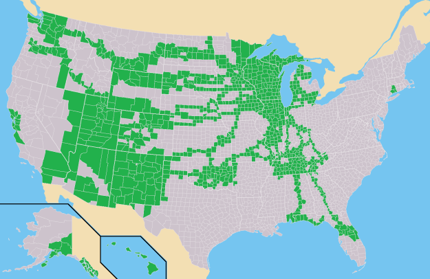
In 2018, I was in three new states and over 100 new counties thanks to trips to eastern Tennessee, Michigan and Oklahoma.  (The new states were Virginia, Ohio and Arkansas.) It’s interesting to pick out the longer distance road trips on this county-level map.  I-75 really sticks out in Georgia since their counties are so small.  There’s the preferred route between Wisconsin and Santa Fe through Kansas.  There’s the time I had to go from Utah to Portland, Oregon.  And our trip to Gulf Shores, Alabama, the week the war started in Iraq.  The string of counties in central Nebraska well off of I-80 was my trek to catch the total solar eclipse in the summer of 2017.

Keep in mind that I dug into my memories from as far back as age 10 to remember what routes we took on family vacations when I initially started this map.  Of course I was pretty much lead navigator by then already so I had an advantage.  My parents eschewed interstate highway travel for much of our Western vacations so I’ve seen a lot more of the Dakotas than your typical Midwestern kid whose family was in a rush to get to the mountains.

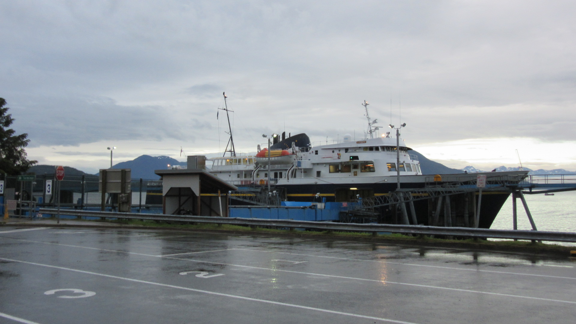
Since I’ve had a major road trip through Canada, I need a similar map for the land of hockey and Tim Hortons:

canada clinched

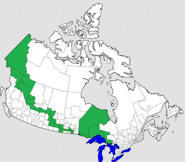
They don’t really have counties west of Lake Superior in Canada but this is close enough.  Here you can see my frequent fishing trips to Northwest Ontario as well as my 2016 drive from Anchorage to Madison.

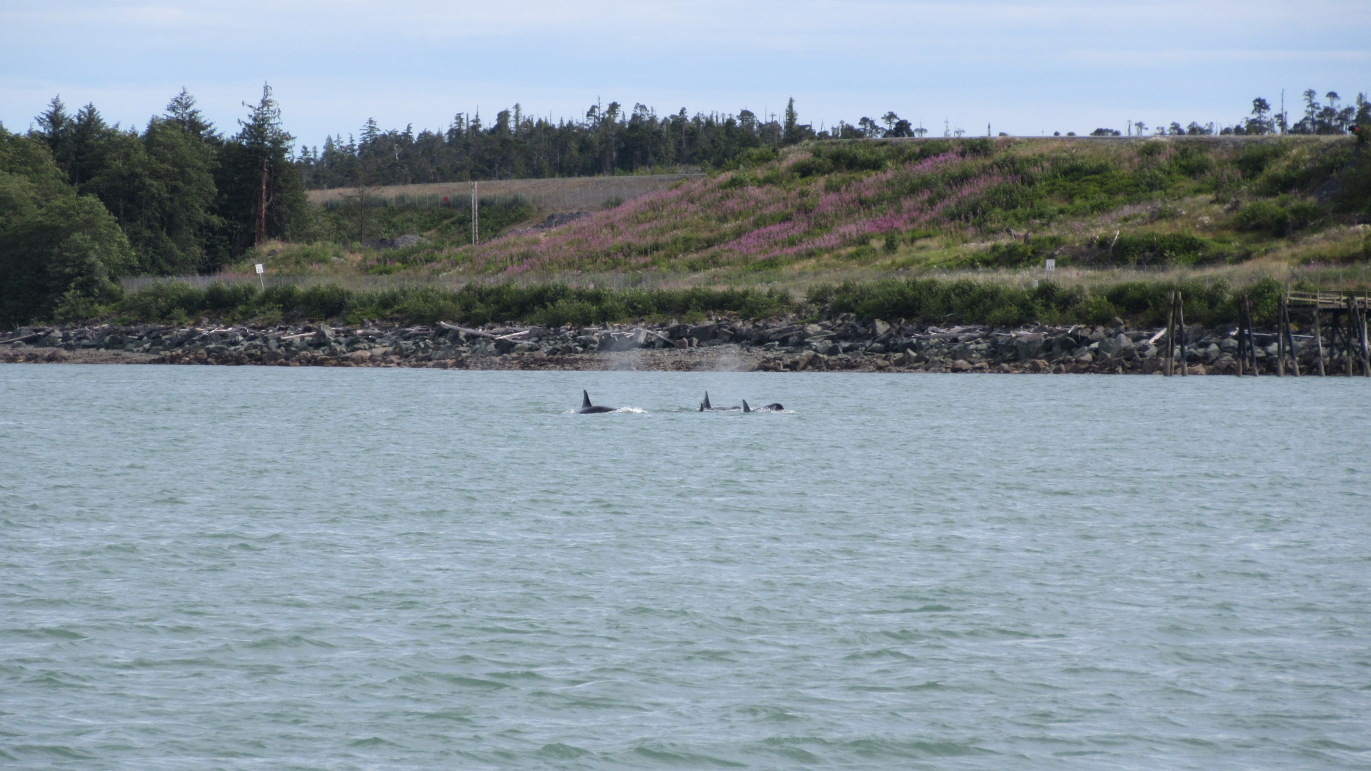
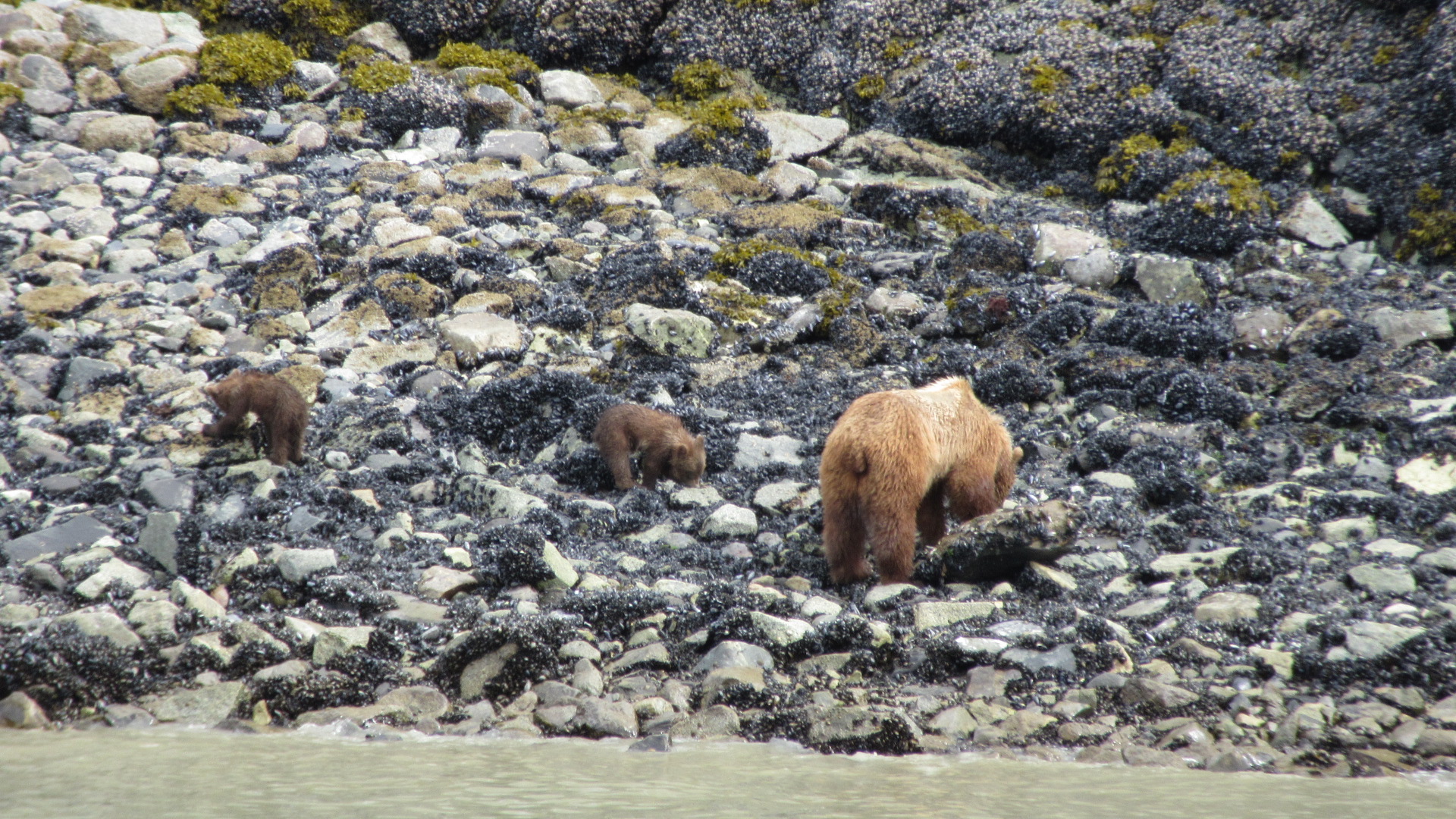
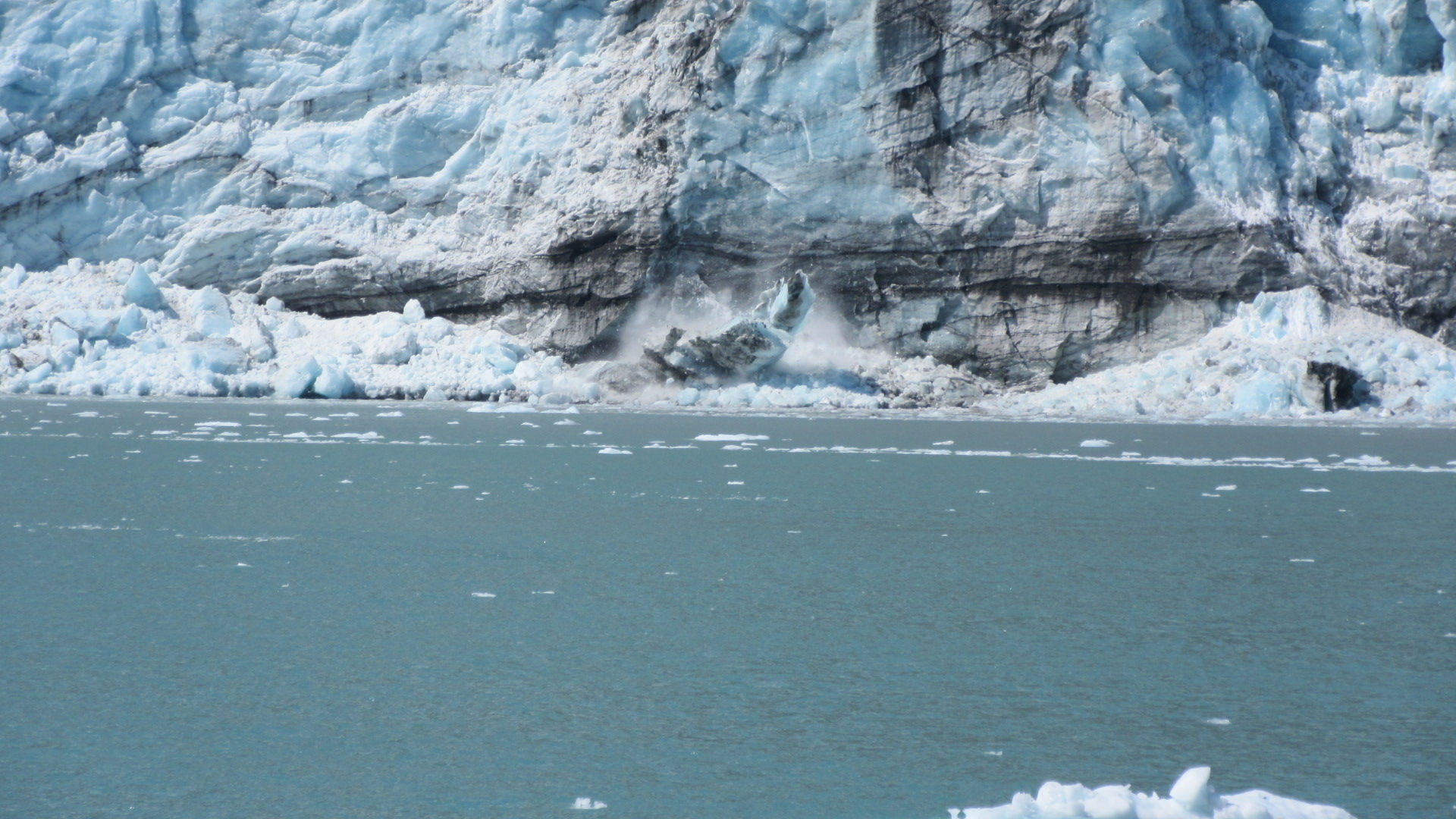
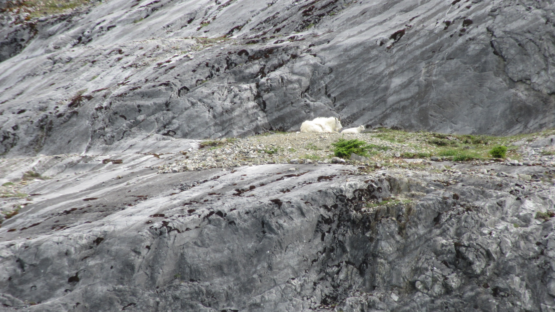
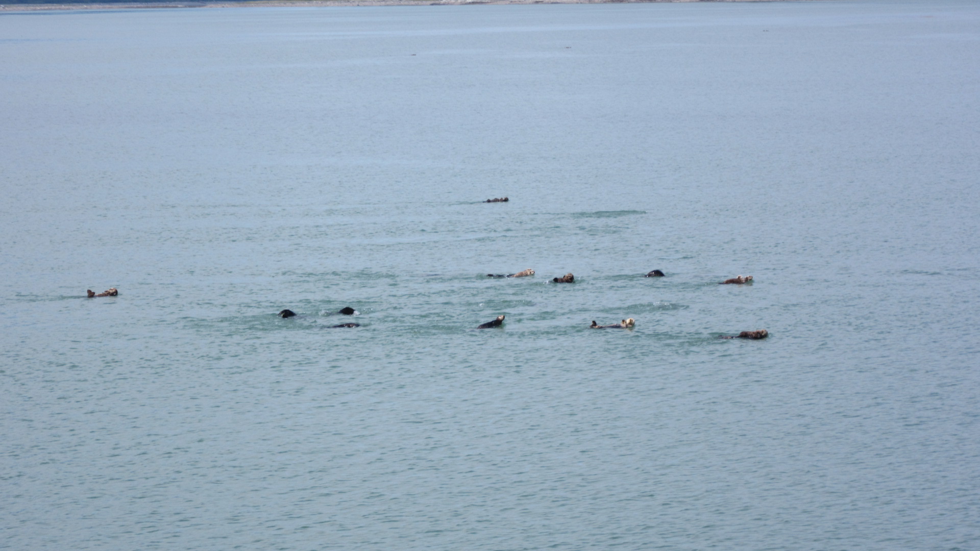
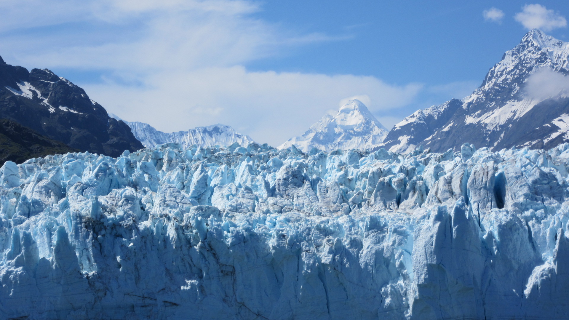
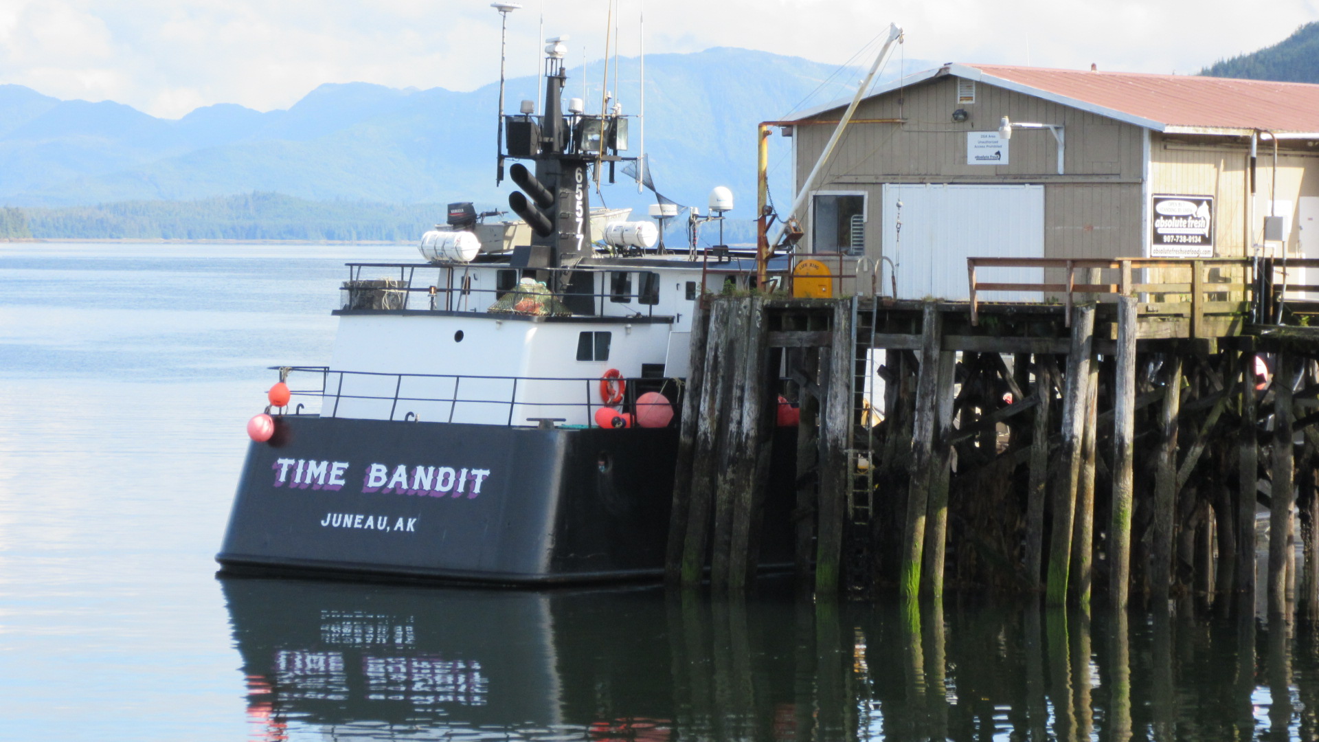
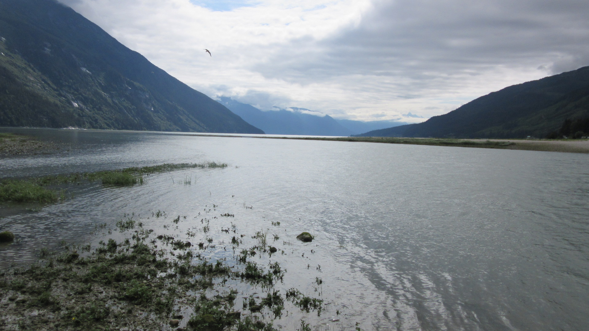
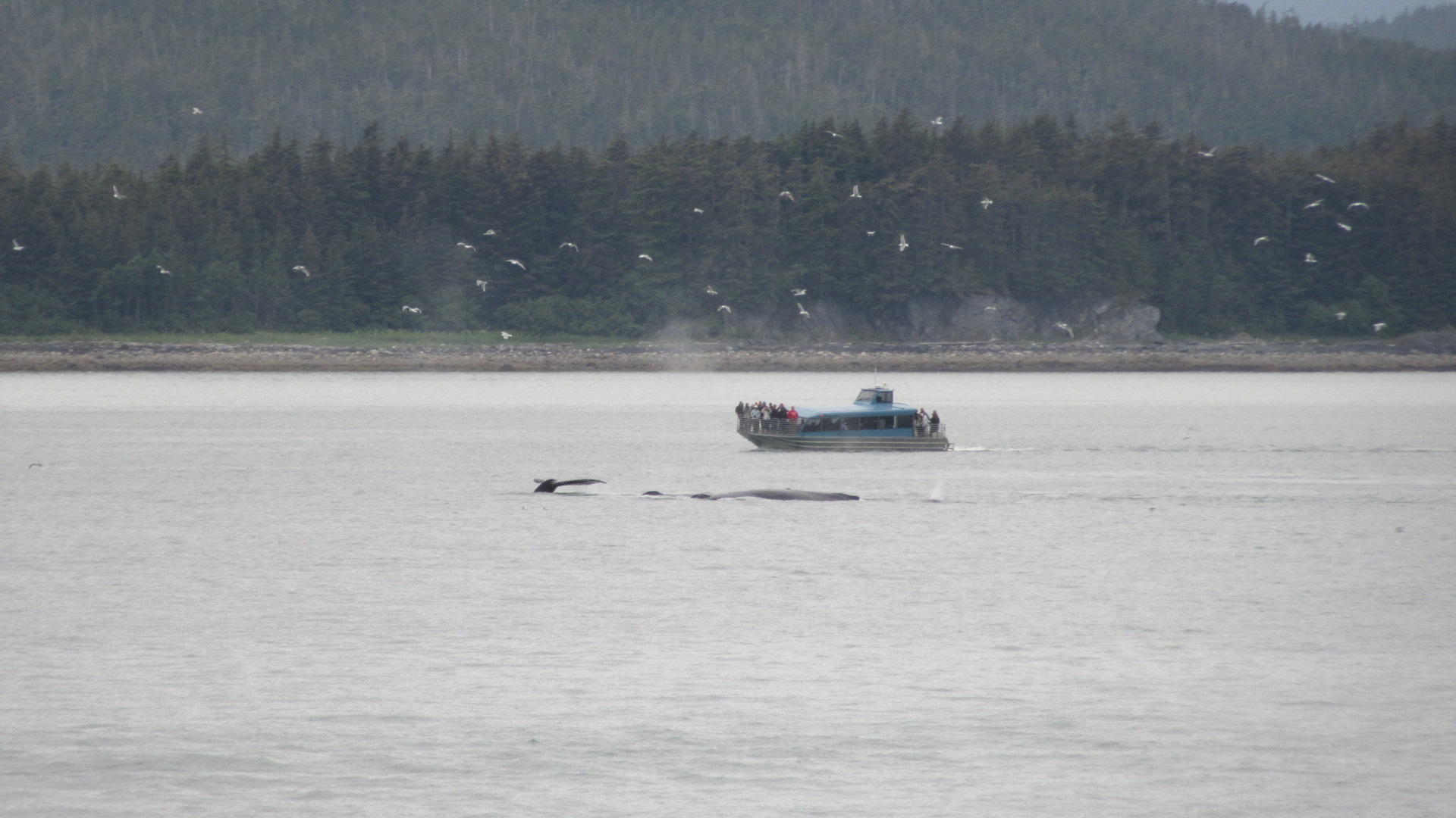
I did sort of drop the ball on not writing about that Alaska Highway trip.  Maybe I’ll backfill someday as it was possibly a once-in-a-lifetime journey.  In fact, here’s a quick shot of Mt. Wrangell from a wide open straightaway on the Glenn Highway.
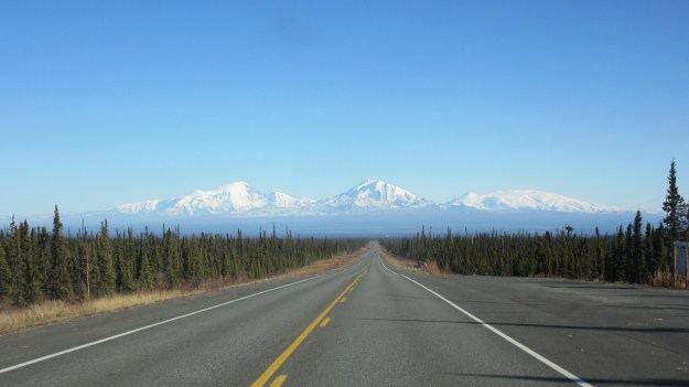
img_2892.


Watch Me Nene

IMG_1743

These are Nenes, the state bird of Hawaii.  Sometimes called the “Hawaiian Goose” it’s related to the Canada Goose most of us see crapping up our parks and lawns.  It lives only on the Hawaiian Islands and very nearly became extinct before Hawaii could even become a state.  Those invasive mongooses had a big impact on the ground-nesting Nene but habitat loss and over hunting by humans didn’t help either.  In the 1950’s, the wild population was down to only a few dozen individuals.

Captive breeding programs and culling of their invasive predators have allowed them to bounce back.  Today Nenes are even recolonizing on their own islands they were wiped off of decades ago.

I spotted a group of four grazing a lawn at Hawaii Volcanoes National Park.  There was no indication of their dance skills.  😉 (Ask your kids.)

Living with Lava

Folks on the island of Hawaii live in a dynamic environment.  Sometimes, though, that environment gets a little too dynamic for comfort.  They are living with the most active volcano in the world.  Since 1983, Kilauea and its associated vents and craters have been in a continuous state of eruption, piling new material onto the island and transforming the landscape.  The eruption has been docile by the standards of volcanology; a steady stream of slow moving lava flows periodically switching among any number of openings in the Earth.  At present, the main crater of Kilauea is in the 7th year of venting mostly gasses while some 20 miles east, lava is flowing from a peak known as Pu’u O’o.  For most of the last 30 years, the bulk of the lava has been sent southeast toward the sea.

In June of last year, a surge of lava from the Pu’u O’o Crater worked its way down the northeast flank taking a more inland route than ever before during the modern eruption.  The lava was making a bee-line for the town of Pahoa.  Pahoa is the nearest community to where I have been staying on the Big Island.  It’s the last town one passes through on State Highway 130 before heading off to the various subdivisions and shore accesses on the east end of the Big Island.

Pahoa map

As the lava flow approached the edge of town, it not only threatened the community itself, but everyone was worried it would push across the only road in to and out of the east end of the island.  To prepare for this possibility, a road was hastily constructed east from Hawaii Volcanoes National Park in the summer of 2014.  Fortunately for Pahoa and everyone living east of there, the lava’s advance toward the town came to a halt before it swallowed the town’s garbage transfer station; the first of many buildings it would have engulfed.

IMG_1593

The emergency road stands ready however, should the volcano send more new land toward Pahoa and State Highway 130.  Until then, it is closed to the public.  Both locals and the National Park Service don’t want the extra traffic.

Puu Oo map

Due to the nature of my job, however, I had an opportunity to drive this unique road.  A modest gravel path that hugs the undulations of recently cooled lava.  And I do mean recent.  Some of this rock was molten during the last Presidential election.

IMG_1798

It was a really cool opportunity to stand on the newest piece of American real estate a few feet closer to California than just a couple years ago.  At present, there is no lava dumping into the sea anywhere on the island, so for now, this is as new as it gets.  But given the history of the islands and Kilauea especially, it won’t be long before the flows shift back toward the Pacific and the volcano’s construction resumes.  It may turn out that I was one of the few people to drive this road before the next surge of lava once again makes it impassible.

IMG_1806

The Mongoose is Loose

Since the 1880’s, the Big Island has been home to the Small Asian Mongoose; a native of India.  They were brought here by owners of sugar cane plantations who were having problems with another invasive species; the rat.  Rats follow humans wherever we go and found their way to Hawaii as soon as someone showed up in a ship big enough for them to hide in.  The rat is a pest for many agricultural activities and the plantation owners were looking for a solution.

When they heard that some guy in Jamaica had success controlling rats by releasing a bunch of mongooses, they got some of their own.  It seemed to make sense.  The mongoose is a speedy predator and could make quick work of a lowly rat.  Just look at that face; he’s a killer alright.

IMG_1594

Unfortunately the great benefit they heard about was sorely overstated.  The mongoose does its hunting during the day to take advantage of its high visual acuity.  The lowly rat, meanwhile, does most of its feeding and scurrying around during the night to take advantage of its night vision and superior sense of smell and touch.  So while the mongoose may be willing and able to kill a rat, the chances of them running into each other is pretty low.  Each is sleeping while the other is feeding.

Instead of eating all the rats, the mongooses went for any number of other prey including ground-nesting birds.  They may not have ate as many rats as hoped, but they sure did breed like them.  130 years later, the island is stuck with hoards of mongooses and the state bird is a threatened species.

We humans seem to have a knack for creating a problem and then making it worse because we jumped on a solution that sounded right without checking to see if it would really help.

Big Island Base Camp

The company has put my coworker and I up in a rental property while we work the Big Island.  It’s a nice place 20 minutes or so from Hilo.  There’s an ocean view, but I can’t take a good picture right now with the sunrise.

IMG_1570

We are just two little blocks from the ocean.  But the coast is not exactly “beach-like” on this corner of the island.  Sharp basalt boulders don’t mix well with waves and human bodies, so I shall swim elsewhere.

IMG_1564

Being on the rain forest side means it’s usually raining by mid afternoon.  But it also means the forest is lush with all kinds of vegetation I can’t even begin to identify, save for the ones with fruit I recognize.  Coconut palms are everywhere and there’s even a new one growing from its over-sized seed on the edge of the yard.  This picture also has bamboo and a young banana tree in it so I guess I know more than I thought.

IMG_1571

I mentioned a tropical storm in my last post.  Hilda fizzled into a non-event, as predicted, producing only some nuisance rain as far as I was concerned.  I took it in stride and went to the movies while Hilda’s remnants staggered ashore.

Jake B’s Hawaiian Adventure

So long Alaska, hello Hawaii.  Or “aloha”, I suppose.

Yes, it seems my whirlwind of cool places has brought me to The Big Island out here in Hawaii.   It’s the same old job on the work end, but the severe change in latitude and longitude has taken me from the subtropical evergreen forests of southeast Alaska to an actual rain forest on the southeast end of the Big Island.

Already I have seen some of the stark contrasts this island has to offer.  The thick vegetation of the jungle sudden breaks into the cracked and crumpled starkness of a basalt lava flow younger than myself.

IMG_1543

This moonscape is in turn broken by the brilliant azure of the Pacific Ocean where 10 foot waves thunder into the jagged shore.

IMG_1556

The house I am staying in for the next month has no A/C so the open windows let in the chorus of insects and the invasive Coqui Frog.  Though the frogs are considered a nuisance by local standards, I find the calls soothing when combined with the drone of a fan.  Just like a warm spring night in northern Wisconsin.

Hawaii does have a lot of problems with invasive species, however, and I’ll probably touch on that some more in the future.

Meanwhile, I should mention that there is this weak hurricane slowly making its way toward Hawaii.

Hilda 10Aug15 2100

But by the time Hilda brushes up against this island it will barely be able to muster the title of “Tropical Storm”; if that.  There’s a lot of upper-level wind shear that will smack it down in the next two days and it will only be a gusty rain event when it gets here.  It has produced some cool surf on this side of the island.  Expect some more content related to this little weather event in the next few days.

Playing with Dollies

This is actually a post about fishing.  Specifically, the Dolly Varden Trout.

They are quite common to the inland streams and near-shore areas of Southeast Alaska and have a range that extends down the coast into Washington.  It’s such a peculiar name for a fish that I had to look it up.  Apparently it is named for a colorful style of women’s dress popular in the 1870’s when the species was first described scientifically and the dress itself derives its name from a character in a Charles Dickens novel.  I had assumed it was the name of some river somewhere, but the truth is way more interesting.

Dollies, as they call them up here, are close relatives of one of my favorite sport fish, the Brook Trout, along with the other species of char such as the Lake Trout and Arctic Char.  Inland Dollies look a heckuva lot like Brookies.

Dolly vs. Brookie

Very similar, aren’t they?  The top one is a Dolly Varden Trout I caught outside Ketchikan.  The bottom one is a Brook Trout I caught earlier this year in Wisconsin.  The main difference is the worm-like markings on the Brookie compared to only round spots on the Dolly.  Additionally, the inside of the Dolly’s mouth is white while the Brookie’s mouth is black.  Dollies tend to have a more slender body shape compared to the stockiness of the Brookie.

Much easier to tell the difference when you catch a Dolly from the ocean.

IMG_0282

Instead they start looking like every other salmon and trout in the ocean; silvery with spots.  Like most trout, Dollies strike a lure aggressively and fight better than their size might indicated.  They are pretty good at throwing a hook with their aerobatics above and below the water.  It has provided good entertainment while the salmon bide their time waiting for higher waters in the rivers around here.

One final similarity between the Dolly Varden and Brook Trouts.  They are both delicious.

IMG_1467

Orcas

Apologies for the lull this month, but I have been staying in some places with shaky or non-existent internet.  And a head’s up to Verizon users; your phone will have no “G’s” on Prince of Wales Island.  😉  So let us play catch-up.

Of all the awesome wildlife that calls Alaska home, one species has remained elusive through two and half summers.  Then two weeks ago, right in the middle of Ketchikan, I finally saw them.  A pod of orcas moving north through the Tongass Narrows.

IMG_1432

Many may know them as killer whales, but I like the name orca better, mostly because they are not whales, but porpoises.  I find it amusing that after a thousand miles racked up by ferry and an all-day tour of Glacier Bay, I didn’t catch a glimpse of one single orca until I came to one of the largest cities in the region.  The hill slope in the background is a taxiway for the airport in Ketchikan and the small ferry that takes people there docks just the the right of this image.  Just goes to show that in a place like Alaska, you don’t always have to be way out in the wilderness to see some of the coolest animals on the planet.

Competition

Fishing in Alaska can be a competitive sport thanks to the abundant wildlife that also enjoys fresh fish.  Take this little guy in Glacier Bay.  I’m casting off the dock when along comes a river otter with some sort of flatfish in its mouth.IMG_1113

He pops up on part of the dock and proceeds to chow down on his catch pausing to make sure my colleague and I are not getting too close to maybe muscle in on his dinner.  I saw a lot of sea otters in Glacier Bay, but this was a river otter.  The smaller size and monochromatic fur easily distinguish it from its cousin.

IMG_1123

A few days later, it was the bald eagles in the estuary of the Chilkoot River outside of Haines.  These bold birds thought that when they saw a fish struggling near the surface, there was an easy meal to be had.  It seemed to take them until the last minute to notice that the fish they saw was already claimed by the human standing on the bank.  I had some very close fly-bys related to a nice Dolly Varden Trout I was keeping for supper.

IMG_1337

There was a moment or two where I wasn’t sure the eagle would break off its attempt at the fish laying three feet from me; to the point where my brain had begun the fight or flight thought process.  Another half-second and maybe I would’ve been ducking.

The Chilkoot River was between salmon runs while I was there, so I suspect the eagles were getting hungry in anticipation of the arrival of thousands of Sockeyes in just a couple weeks.  By mid-July, they probably would have paid me no mind.  Like so much else in life, cool wildlife encounters sometimes come down to simple timing.

Window Into the Wilderness

Glacier Bay National Park is a place I experienced on foot for a few hours last summer and it was a lot of fun.  A short hike with my fishing gear in tow yielded a rain-soaked afternoon of wilderness solitude.  But Glacier Bay is a water-oriented place and is best seen from some sort of watercraft.  You can cover far more area and see much more of the exotic wildlife the park has to offer.  So this time out, I availed myself of one of the guided boat tours available every day in summer.

The good ship St. Phillip didn’t even push off from the dock before the first few humpback whales were spotted, thus setting the tone for a spectacular day.  Eleven hours and many, many photographs later, I had a solid, first-hand appreciation for one of the most fabulous places on the entire planet. The symphony of land and water and life does not care that it impresses you, but it does.  The most incredible thing about a wilderness like Glacier Bay is its indifference to your presence.  A brown bear beach-combing for a meal pays no attention to the metal craft floating a hundred meters offshore despite the clicking shutters and grumbling engine.  The massive wall of ice doesn’t care who is watching when it sloughs a hundred tons of itself into the ocean.  The frozen peaks are unconcerned that the clouds have given way and exposed them to human eyes for the first time in a week.  This is a place where the dominance of natural forces is obvious to anyone who visits.

I watched a brown bear overturn large boulders as if they were made of cork.

IMG_1225

I felt the great thunder of ice plunging down a 200 foot frozen escarpment.

IMG_1258
Sea lions jockeyed for position on a marble exposure jutting from the bay.

IMG_1167

A mountain goat and her kid rest on a patch of grass high above the cold waters.

IMG_1208
More sea otters in one photograph than lived in the entire bay 30 years ago

IMG_1303
Then there is breath-taking vista after breath-taking vista, including some rare glimpses of Mt. Fairweather; highest peak in the park.  The name is a bit ironic since frequent clouds, fog and rain shroud the entire south end of the St. Elias Range on most days.

IMG_1264

Summer is Coming…

For my first adventure of this year’s Alaska trip, I took advantage of some downtime during an 80-degree heatwave in Juneau to return to Mendenhall Glacier.  Just like last time, it was a fantastic and challenging day hike.  But what a difference a year makes when it comes to the sights at the glacier itself.

The spectacular ice cave I explored last summer had melted away completely.

ice tunnel before & after

The melting ice freed an entire ridge from a frosty tomb for the first time in centuries.  These two pictures don’t come from the exact same spot, but I identified a few reference points on the crest of the newly exposed ridge.

2014 toe

2015 toe

These mountain glaciers are dynamic environments and it’s amazing to see this change in person.  This vantage will be completely different again next summer for anyone who gets to hike in.

Funnel Cloud

This place will see more activity for much of the summer as I am returning to Southeast Alaska for another go-round for work.

But first I gotta get there.  I’m in the middle of three day road trip to Bellingham, Washington where the collection vehicle will catch a boat to Juneau.  It’s been an awesome drive, traveling about half the length of I-90, America’s longest interstate highway.

Today was very unique because a few miles into Montana, we spotted a funnel cloud jutting from a large thunderstorm a few miles from the highway.  I was riding shotgun and was able to snap some pics when the terrain allowed.

MT funnel 1

I’ve never spotted a tornado before.  Which is a good thing, I suppose, but I always thought it’d be cool to see one in the distance while traveling out West where the visibility is long and there are no people in the way.

MT funnel 2

This little funnel was short lived, as was the intensity of the storm that produced it, and I never saw it reach the ground, making it technically not a tornado.  The weather resources I was monitoring never gave out any alerts about the storm before it waned.  The area was extremely rural so it couldn’t have been a threat to more than a couple of ranches.  I wonder if the National Weather Service even knew about this one.

Walking Into Clarksville

I’m debating whether or not to acknowledge the title of this post.  Is the reader going to recognize the homage to the album that briefly united Robert Plant and Jimmy Page or will the reader think I’m a dummy who misremembered the album title?

At any rate, I post this from a very wintery Clarksville, Tennessee, where I’m at the front end of a new project.  Once the weather breaks, I will spend the rest of this month circumnavigating Nashville, one county at a time.  It’s a remarkable change from the mountains and wide open deserts of New Mexico.  After so much time out west, it’s nice to see lots of trees and streams with water in them.

IMG_0541

I had to deal with some sketchy travel conditions along the way but made it in one piece.  Some folks just don’t get it though, when the roads are snowy and the bridges are icy.  You are not as good a driver as you think you are.  If you must travel, do yourselves a favor and take it easy when the roads look like this.

IMG_0898

I have been to Tennessee before, but only passing through.  So this is effectively new country for me.  A fun part of my job is exploring new areas and what they have to offer.  I know I’m looking forward to the barbeque and whiskey.

Is This Thing On?

Even before it was brought to my attention, I was aware that I was neglecting this space for far too long.  A little bit of apathy mixed with spending several months in places I have been before combine to create a lack of inspiration for updates.

But hey, you’ve waited longer for new episodes of your favorite TV shows. 😉

The first months of 2015 find me back in New Mexico and revisiting many of the same roads I traveled in late 2013 and early 2014.  The familiarity is both an asset and a burden.  On the one hand, I know where some cool spots are and can work the project schedule to accommodate being near nicer towns.

For example, the ample day hiking opportunities in the Silver City area.

IMG_0872

But I also know just how crummy certain roads are and what types of local events and industries make it difficult to operate in certain areas.

The rest of this month, I will be doing work in the north central part of the state in the area of the Sangre de Christo and Jemez Mountains.  This being February, it’s the peak of ski season and that means lots of tourists on the weekends.  Especially this year since mountains further south (and closer to Texas) are lacking snow.  Which means I’ll be spending many a night in Santa Fe for a while.  But more on that in a future post, maybe.

For now, have a look at the state bird of New Mexico running around a gas station in the middle of the state’s largest city just a couple miles from the central business district.

IMG_0885

Meep, Meep!

One Last Cast

My time in Alaska has come to an end.  It’s off to the next assignment; which just so happens to be a return to Utah for a couple weeks.

Alaska has been amazing.  And getting paid to be up there wasn’t bad, either.  The day before I left, I wanted one more chance to catch some fish, so I headed a few miles outside of Ketchikan to a small lake about a mile upstream from the ocean.

The lake was jammed with Pink Salmon.  After a bit of trial and error with different lures, I found one they liked and had a great time wrestling a few of them to the shore.  Pink Salmon are also called “Humpback Salmon” and it’s easy to see why.

IMG_0589

I eventually lost that lure and packed it in.  The lakeside trail took me back to the van through monstrous old-growth Sitka Spruce.  The entire area has a real “Forest Moon of Endor” vibe.  It was a great way to wrap up an outstanding trip filled with unbelievable scenery, awesome wildlife and fantastic fishing.  And we managed to complete everything we needed to on the business end, but who’s going to remember that?

On to the next adventure!

Other Sea Life

In a departure from the popular images of salmon, whales and cute mammals, today I will present some other interesting life I’ve encountered.

I’ll start with this beauty.

staghorn sculpin 2

It’s a Staghorn Sculpin.  I’ve caught a handful of these over the last two months.  Though they look weird, they are perfectly harmless; no spines or teeth.  The name comes from the unique shape at the point of the gill plate.

On another day, my lure blundered into a dense school of baitfish, snagging one in the process.

IMG_0160

I’m not 100 percent certain, but I believe it is a species of smelt.

Jellies are an extremely common form of life in the world’s oceans.  When the waves are calm and the lighting is good, I have frequently seen them from the decks of ferries and drifting by from the shore.

IMG_0399

Low tide is a wonderful time to observe a plethora of interesting creatures.  This image of a small crab also has a bunch of snails and a limpet.

crab

Only once have I been at a location where tidal pools contained sea stars.  Naturally, I needed to take a closer look.  At this spot, nearly ever surface of every rock was covered with mussels and barnacles.

IMG_0404

My time in Alaska is drawing to a close.  With all the work complete, I am back in Ketchikan getting things ready to ship out.  The streams around here are full of chum salmon right now, so am going to see what I can do about that in the time I have left.

What’s that rattle?

I woke up a few minutes before 3 a.m. last night and my hotel room in Juneau was bumping around.  In my grogginess, it took a few seconds to realize it was an earthquake.  First one I’ve ever experienced.  Couldn’t have been much longer than 30 seconds in duration.

http://earthquake.usgs.gov/earthquakes/eventpage/usb000rx5i#summary

It was a 5.9 about one hundred miles to my west, which places it along the main fault between the North American & Pacific Plates.  This is a transform plate boundary, same as exists in California.  The ocean floor is moving north relative to North America in southeast Alaska.

Nothing’s damaged or broken except the internet.  The work phone is getting through, but barely.  I can’t even send a text on my own phone right now.  But I’m probably a few millimeters closer to western California now! 😉

Fishing With The Seals

Another day, another river joining the ocean in a tidal estuary.  This one is the is the Chilkoot River and it’s the river to the east of Haines.  Haines sits on the eastern shore of a long peninsula that separates two long fjords fed by glacial-charged rivers.  Back in the paddle-power days, Haines served as a shortcut between the two river mouths, a two mile portage over level terrain being preferable to a 30 mile paddle.  These days, Haines is the quiet alternative to tourist-heavy Skagway as a place to transition from the Marine Highway to the more conventional highway.

IMG_0444

On this day, I selected the Chilkoot, to the east, over the Chilkat, to the west, because it had a lake just a mile upstream.  I didn’t wind up fishing the lake, but it looked cool on a map.  Instead I followed the receding tide downstream throughout the morning and into early afternoon.

Tides are an interesting phenomenon for this Midwest boy.  I’m not used this dramatic, short-term change in water level.  At the heads of these long inlets and channels far from the open ocean, the tide can shift the water 20 feet or more up and down in just 12 hours.  At a shallow estuary like the one at the mouth of the Chilkat River, this can mean the shore at low tide is a mile away from the shore at high tide.  I stand at the water’s edge and three casts later, I can take another two steps forward.

The creatures that live here are used to the tides, though.  During their spawning runs, each rising tide brings another wave of salmon upstream into the river.  Each receding tide forces the stragglers to retreat from the shallowing water.  Predators of the salmon know this.  Everyone is familiar with photogenic congregations of eagles and bears at opportune places up and down the northwestern coast of the continent.

But the nature has a three-pronged attack in store for the salmon.  The bear comes from the land, the eagle comes from the sky, and from the water comes the harbor seal.

IMG_0480

As I fished, I noticed one seal swimming around way downstream from me and it was pretty neat.  Then I saw it was actually two different seals.  I moved further downstream, following the receding tide, and two seals had become four.  Then it was more like 10.  By the time I had moved a quarter mile toward the ocean, I realized there were dozens of seals patrolling the mouth of the Chilkoot.

I had to wait more than once for a seal to move out of the way so I could cast.  At first when they surfaced near me, they bolted back underwater.  But as time passed, they were less threatened.  Instead they just wanted to make sure they knew where I was.  A seal would pop up within casting distance and it would boost it’s head higher in the water to see over the standing waves created by the current and get a clear view of me, then let the current float them away from me.  I can only describe that behavior as adorable.

Frustratingly, the seals were having much better luck fishing that I was.  Multiple times a seal would appear with a freshly caught salmon in its mouth.  As before, they would look to me to verify I was still a non-threat, but in doing so created the illusion that they were mocking me.  “Oh hey, is this what you’re looking for?  Yeah there’s a whole bunch down there.  And they’re delicious.”

seal w fish

I eventually caught this female Sockeye Salmon.  But the seals definitely out-fished me.
Talk about a unique experience.  Fishing along side a dozen seals with massive, cloud-draped, avalanche-scarred mountains above me.  Alaska is pretty awesome.

IMG_0478

Ferry Tales

I’ve taken ferry rides a few times in my life.  Both crossings of Lake Michigan.  The long ride to Isle Royale from the U.P.  A hour or so across the mouth of Puget Sound.  It’s always a fun departure from the normal modes of transport.

For the last month and a half, my life has revolved around ferry schedules as we move from island to island via the Alaska Marine Highway.  The voyages all have stupendous scenery as the ships travel across wide sounds and through narrow channels.  Sometimes the land is so close it looks like you could jump to the shore from the boat.  Other times, fog and rain make it impossible to tell what direction you are going.

IMG_0122

There’s always plenty of wildlife to see.  Lots of wading birds, water fowl, terns, gulls, eagles… Every so often you catch a glimpse of an otter or a seal.  Whale sightings are virtually guaranteed in the summer.  A half hour out of Juneau on one trip, an armada of sightseeing boats drew my attention and soon the water’s surface erupted from the exhale of one of Earth’s largest animals.  With the boat and the people in the background, you start to get a sense of how huge a whale really is.

IMG_0386

The Alaska Marine Highway was set up not long after statehood as a way to provide regular, affordable service between the communities scattered among the archipelago of islands in southeast Alaska.  Many of the ships are the same ones that debuted along with the system.  They’ve got big ships to make the long hauls up and down the coast, smaller ships to make daily runs between closer towns and a couple fast ones for trips between more populous cities.  All of them are named after glaciers in Alaska.

This one is the M/V LeConte and it was actually built in Wisconsin; Sturgeon Bay to be specific.

IMG_0358

Alaska is truly an international travel destination.  People come from all over the world to see the fjords, mountains, wildlife and glaciers and absorb the local culture.  This part of America is actually closer to places in Europe than it is places in the United States as the crow (or the Airbus) flies.  It’s a much shorter trip to Alaska from Hamburg or Oslo than it is from Atlanta or Miami.  One evening, I shared the ferry’s lounge (bar) with half a dozen Germans, two French speakers and an Aussie.  It was rather funny watching that Aussie chat up a grad student from Montana on her way to gather data on bears for the summer.

Any ferry ride of at least a couple hours will have food available.  Comes in handy when you need to catch an early ferry and couldn’t stop for a bite beforehand.  Only the largest of the ferries have a dedicated lounge with a full bar.  They do a good job of stocking local brews from Juneau.  The decor can be quite “vintage”.  The best example being the bar on the M/V Columbia.

IMG_0437

Funky.